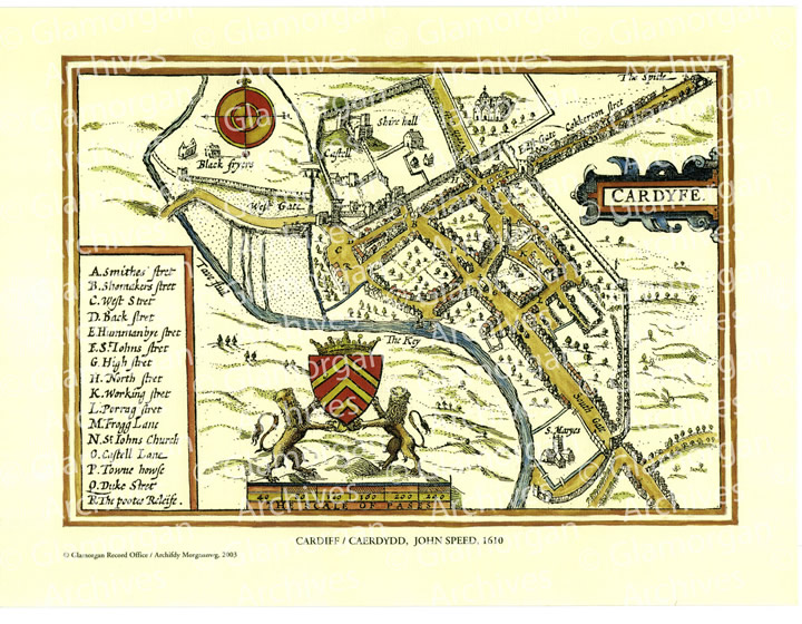
John Speed’s Plan of Cardiff 1610
This full colour map depicts individual buildings including the castle, town hall, churches and former priories, together with the old walls and gateways, and names streets. The plan is a facsimile taken from Speed’s ‘Theatre of Great Britain’, an atlas of county maps published in 1611.
(38cms X 28½cms; 15″ X 11¼”)


